

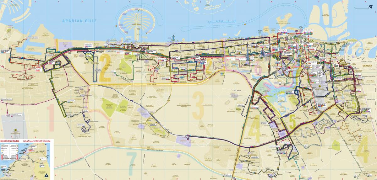
You can find on this page the Dubai buses map to print and to download in PDF. The Dubai bus system map and the Dubai trolley map present the network, stations and lines of the buses and trolley of Dubai in United Arab Emirates.

The Dubai bus map shows all the stations and lines of the Dubai bus system. This bus map of Dubai will allow you to easily plan your routes in the buses of Dubai in United Arab Emirates. The Dubai bus system map is downloadable in PDF, printable and free.
Dubai's bus network has grown in recent years and serves the entire country. It is an economical means of transport but buses are often overcrowded at peak times or on certain routes. Buses run between 6:20am and 11:45pm every day. The buses are air-conditioned and have access to handicapės. A section is always reserved for women and children.
The Dubaï bus network which transports 109 millions passengers per year is operated by the RTA (Roads and Transport Authority). Its network includes 140 lines. The Dubai government is focusing its efforts on developing the bus network in the city. In recent years, the Roads and Transport Authority (RTA) has established a bus network in Dubai consisting of 1500 buses.
All the buses in operation are new and the bus stops are air-conditioned. Buses in Dubai are very modern and air-conditioned, with information screens showing the route, direction, next stops and other essential news about the road network. Dubai's bus network consists of 119 routes, including one night route. The cost of a bus journey depends on how many fare zones you pass through during your journey. Dubai's bus network serves the entire city, linking tourist areas, residential, industrial and business districts.